- Dehradun (Jolly Grant Airport, DED) is the nearest airport, located 165 km away (5.5 to 6.5 hours mountain drive via NH 34).
- Regular early morning UTC hill buses depart from Dehradun Hill Bus Station (near Railway Station) and Rishikesh Natraj Chowk between 5:00 AM and 10:30 AM.
- Shared Mahindra Bolero / Maxx jeeps depart throughout the morning from Rispana Pul in Dehradun and Rishikesh Taxi Stand (₹400 to ₹550 per seat).
- Two road corridors exist: the scenic Mussoorie–Chinyalisaur route (145 km) and the wider double-lane NH 34 highway via Rishikesh–Chamba–Dharasu (175 km).
- Connecting transport from Uttarkashi to trek basecamps: shared jeeps run daily to Bhatwari and Raithal for Dayara Bugyal, and to Gangotri for Gaumukh Tapovan.
The Gateway to Northern Garhwal
Uttarkashi sits at an altitude of 1,158 meters (3,799 feet) along the Bhagirathi River in Uttarakhand. It serves as the primary base for legendary Garhwal Himalayan treks, including Dayara Bugyal, Gaumukh Tapovan, Kedartal, Dodital, Nelang Valley, and Gartang Gali. The town is also home to the prestigious Nehru Institute of Mountaineering (NIM).
Planning your road journey from the northern plains into the mountains requires understanding departure stations, early morning timings, route options, and road conditions.
Distance, Travel Time & Fare Matrix
| Starting Hub | Distance | Average Drive Time | Primary Route | Public Bus Fare | Shared Jeep Fare | Private Cab Fare |
|---|---|---|---|---|---|---|
| Dehradun | 145–175 km | 5.5 to 6.5 Hours | Mussoorie or NH 34 via Chamba | ₹280 – ₹350 | ₹400 – ₹550 | ₹4,200 – ₹5,500 |
| Rishikesh | 162 km | 5 to 6 Hours | NH 34 via Chamba & Dharasu | ₹270 – ₹340 | ₹400 – ₹500 | ₹4,000 – ₹5,200 |
| Haridwar | 188 km | 6 to 7 Hours | NH 34 via Rishikesh & Chamba | ₹320 – ₹400 | ₹500 – ₹650 | ₹4,800 – ₹6,200 |
| New Delhi | 390 km | 10 to 12 Hours | Meerut Expy → Roorkee → Rishikesh | ₹650 – ₹950 (Combined) | ₹850 – ₹1,100 | ₹9,500 – ₹13,000 |
Route Option 1: Reaching Uttarkashi from Dehradun
Dehradun is the most frequent transit hub for trekkers arriving by train at Dehradun Railway Station or by air at Jolly Grant Airport.
1. The Direct Scenic Corridor: Via Mussoorie & Suwakholi (145 km, ~5.5 Hours)
- Route: Dehradun → Mussoorie bypass → Suwakholi → Dhanaulti bypass → Moriana Top → Chinyalisaur → Dharasu Bend → Uttarkashi.
- Road Characteristics: This route climbs through the oak ridges of Mussoorie before descending into the Bhagirathi valley at Chinyalisaur. It is 30 km shorter than the Rishikesh route.
- Scenic Highlight — Moriana Top: A mountain pass offering panoramic vistas across the Bandarpoonch and Gangotri mountain massifs before the road winds down to the Chinyalisaur airstrip.
- Best For: Private taxis and morning shared cabs seeking the fastest direct connection.
2. The All-Weather Highway Corridor: Via Rishikesh, Chamba & NH 34 (175 km, ~6.5 Hours)
- Route: Dehradun → Nepali Farm → Rishikesh → Narendranagar → Chamba → New Tehri bypass → Dharasu Bend → Uttarkashi.
- Road Characteristics: Fully engineered under the Chardham all-weather highway program. Features wide double lanes, concrete barriers, and gradual gradients running along the Tehri reservoir.
- Best For: State transport buses and monsoon travel, offering maximum route stability and gradual elevation gains.
Dehradun Public Transport Stations
- Shared Maxx / Bolero Cabs: Located at Rispana Pul (Rispana Bridge on Haridwar Bypass Road) and Parade Ground Taxi Stand. Jeeps begin boarding at 5:00 AM and leave continuously once filled with 8–10 passengers until around 12:30 PM (fares: ₹400 to ₹550 per seat).
- Uttarakhand Transport Corporation (UTC) Hill Buses: Depart from the Dehradun Hill Bus Stand (situated near Dehradun Railway Station on the Parade Ground side, separate from the interstate ISBT). Direct hill buses depart at 5:30 AM, 7:00 AM, and 8:30 AM (fares: ₹280 to ₹350).
- Private Vishwanath Seva Buses: Operate regular stage carriages between 6:00 AM and 11:30 AM from the Parade Ground terminal (fares: ₹300 to ₹380).
Route Option 2: Reaching Uttarkashi from Rishikesh
Rishikesh is the natural gateway for travelers arriving by train via Yog Nagari Rishikesh (YNRK) or Haridwar Junction.
Route Highlights via NH 34 (162 km, ~5.5 Hours)
- Waypoints: Rishikesh (340 m) → Narendranagar (1,100 m) → Agrakhal → Chamba (1,600 m) → Kandi Saur → Dharasu Bend (850 m) → Dunda → Uttarkashi (1,158 m).
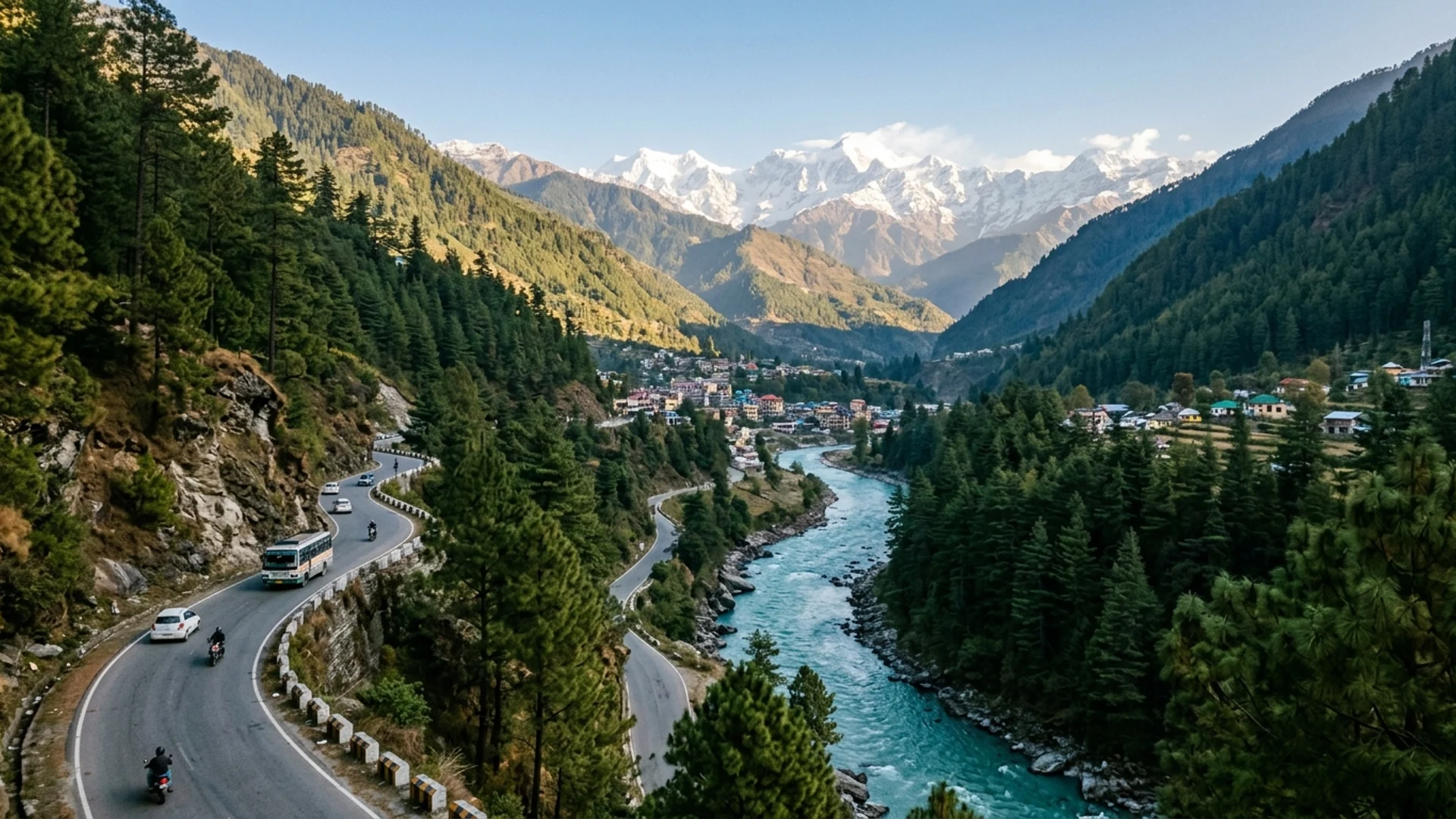
- The Journey: The road climbs through pine forests past Narendranagar, traverses the fruit bowl ridge at Chamba, and meets the turquoise waters of the Bhagirathi River at Dharasu Bend.
Rishikesh Public Transit Boards
- Bus Stand: Hill buses depart from the Rishikesh Old Bus Stand (Railway Station Road) and pick up passengers at Natraj Chowk. Departures run hourly from 5:00 AM until 1:00 PM (fares: ₹270 to ₹340).
- Shared Jeeps: Line up at Natraj Chowk Taxi Stand and near the Bypass Roundabout. Booking is on-the-spot; arriving between 5:30 AM and 8:00 AM ensures immediate departures (fares: ₹400 to ₹500 per seat).
Route Option 3: Journey from New Delhi to Uttarkashi
Recommended Strategy: The Train + Mountain Road Combination
- 1Leg 1 (Delhi to Haridwar/Dehradun):
- Book the morning Dehradun Vande Bharat Express (Train 22457) departing New Delhi Railway Station at 7:00 AM, arriving Haridwar by 11:30 AM and Dehradun by 12:35 PM (6 hours total).
- Alternatively, board the overnight Nanda Devi AC Express (Train 12205) from New Delhi at 11:50 PM, arriving Dehradun at 5:40 AM. This arrival timing connects directly with the 6:30 AM hill bus or 6:00 AM shared Bolero to Uttarkashi on the same morning.
- 1Leg 2 (Dehradun/Haridwar to Uttarkashi):
- Board an awaiting shared Bolero at Rispana Pul or pre-book a private pickup with Yeti Adventure.
Air Travel: Flights via Jolly Grant Airport (DED)
- Direct flights operate daily to Dehradun from New Delhi, Mumbai, Bengaluru, Hyderabad, and Ahmedabad.
- Jolly Grant Airport is located on the Dehradun-Rishikesh highway, 165 km from Uttarkashi.
- From arrivals, pre-booked private taxis reach Uttarkashi in 5.5 hours, bypassing Dehradun city traffic completely via the Rishikesh bypass.
Helicopter Travel: Direct Flight under RCS-UDAN Scheme
- Route: Dehradun (Sahastradhara Helipad) to Uttarkashi (Joshiyara Helipad).
- Operator: Pawan Hans under the Ministry of Civil Aviation RCS-UDAN program.
- Flight Time: Approximately 30 minutes airtime across the Mussoorie ridge.
- Booking & Fare: Tickets cost approximately ₹3,500 one way and are booked at the Heli Ticket Counter at Sahastradhara Helipad. The flight lands at Joshiyara Helipad, located just 5 minutes from our Yeti Adventure operations desk in Uttarkashi.
Onward Transit: Connecting from Uttarkashi to Trek Basecamps
Once you arrive in Uttarkashi, our local team operates from Bonga, Joshiyara. Onward transit connects to trailheads via the following options:
1. Raithal & Barsu (Basecamps for Dayara Bugyal)
- Distance: Raithal is 42 km north of Uttarkashi; Barsu is 45 km.
- Public Transport: Take a shared Bolero from Uttarkashi Taxi Stand heading toward Bhatwari (28 km, ₹70, departs every 30 minutes). At Bhatwari market, switch to a local connection jeep ascending the 14 km winding road up to Raithal village (₹50–₹70).
- Direct Private Cab: Uttarkashi to Raithal takes 1.5 hours (₹1,500 – ₹1,800).
2. Gangotri (Basecamp for Gaumukh Tapovan & Kedartal)
- Distance: 95 km northeast along the upper Bhagirathi river gorge.
- Public Transport: Shared Tata Sumos depart daily from the Gangotri Taxi Stand in Uttarkashi between 6:00 AM and 9:00 AM (₹250 – ₹300 per seat). Travel time is approximately 3.5 to 4.5 hours, passing through Maneri, Bhatwari, Gangnani hot springs, and Harsil valley.
3. Sangam Chatti (Basecamp for Dodital & Darwa Pass)
- Distance: 14 km along the Assi Ganga valley.
- Public Transport: Regular shared jeeps run from Uttarkashi's Bhatwari Road stand directly to Sangam Chatti (₹40 – ₹60, 45 minutes drive).
Essential Mountain Transit Tips from Local Guides
- 1Mountain Road Timings: Uttarakhand hill roads observe a strict night-driving advisory. Commercial passenger vehicles cease operating on the Dharasu-Uttarkashi route after 7:30 PM. Always begin your journey early in the morning.
- 2Motion Sickness Management: The road between Chamba and Uttarkashi contains continuous curves. Trekkers prone to motion sickness benefit from carrying ginger lozenges or taking Avomine/Stugeron 45 minutes before departure, and securing front or window seats in shared jeeps.
- 3ATM & Cash Readiness: Uttarkashi has reliable branches and ATMs for SBI, PNB, and HDFC. Beyond Uttarkashi (in Bhatwari, Raithal, Harsil, and Gangotri), digital network connectivity is intermittent. Keep sufficient cash for personal snacks, porters, and equipment rentals.
- 4Seasonal Buffer: During late July and August, monsoon showers can trigger localized debris on NH 34 near Nalupani. Keep a buffer day when scheduling outbound flights or trains from Dehradun.
Yeti Adventure Mountain Operations Desk
Headquartered at Joshiyara, Uttarkashi along the Bhagirathi River. Led by local mountain pioneers and certified leaders from the Nehru Institute of Mountaineering (NIM), high-altitude first responders, and native Garhwali route guides stationed across Gangotri, Sankri, and Harsil.
Uttarkashi Mountain Operations
Connect directly with local mountain veterans for verified road status, shared Maxx departures, permit guidance, and route advice.
NIM-Certified Mountain Leaders
& Local Garhwali Guides
Daily, 8:00 AM – 8:00 PM IST
Joshiyara, Uttarkashi